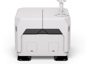
DJI DOCK 3
Rise to Any Challenge
DJI Dock 3, equipped with Matrice 4D or 4TD drones, enables 24/7 remote operations and supports mobile deployment. These drones share Matrice 4 Series cameras but offer enhanced flight and protection. They also pair with DJI RC Plus 2 Enterprise for standalone use. With DJI FlightHub 2, pilots streamline operations, reducing time and costs.
MODELS


Compatible Software


Compatible Models (Dock Version) And Accessories
-

DJI M30 Drone
Add to Cart -
DJI-MATRICE 30T
Out of Stock -
DJI TB30 BATTERY
Add to Cart -
BS30 BATTERY STATION FOR DJI M30
Add to Cart -
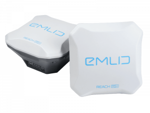
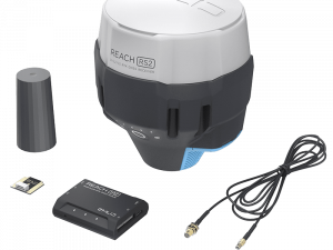
Emlid Reach RS2
Add to Cart -
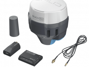
Emlid Reach RS+
Add to Cart -
Emlid Reach RS+ Survey Kit
Add to Cart -
Emlid Reach M2
Add to Cart -
Emlid Reach M+
Add to Cart -
Emlid Reach M2 UAV Mapping Kit
Add to Cart -
Emlid Reach M+ UAV Mapping Kit
Add to Cart -
Emlid Reach M2 UAV RTK Kit
Add to Cart -
Emlid Reach M+ UAV RTK kit
Add to Cart -
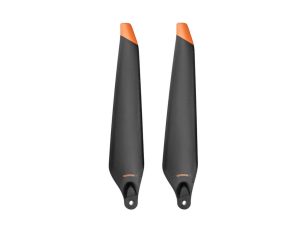
DJI-MATRICE 30 PROP 1671
Add to Cart -
Matrice 30 Propeller
Out of Stock -
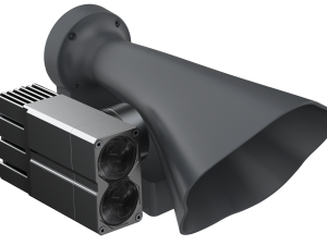
CZI LP12 SEARCHLIGHT AND SPEAKER
Out of Stock -
Sunnylife 2 in 1 Controller Protector for DJI RC Plus
R499.00 Out of Stock -
RC PLUS HEIGHT ADJUSTABLE CONTROL STICKS
R629.00 Out of Stock -
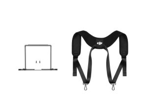
RC PLUS STRAP AND WAIST SUPPORT KIT
R2,199.00 Add to Cart -
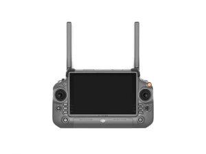
DJI RC Plus
R28,173.00 Out of Stock


We do in house software integration
Fill In the form to Contact Our Dev Team.
Enquire Now On the In house software solutions we offer
Unlock the full potential of DJI drones with our in-house software development services. Elevate your aerial missions with intuitive flight planning, autonomous navigation, data analytics, and custom integrations. Experience the future of drone technology with us today.
Master All Environments
DJI Dock 3 features:
Heat Resistant
Built to withstand extreme heat, DJI Dock 3 operates and charges seamlessly even in temperatures soaring up to 50° C (122° F), ensuring efficient operations.
Cold Resistant
Perform critical tasks reliably despite frigid temperatures in environments where temperatures can plunge below -20°C (-4°F). After preheating, it can operate stably in harsh environments as low as -30° C (-22° F).
Wind Resistance
Both Matrice 4D and 4TD demonstrate remarkable flight performance. In winds as strong as 12 m/s, they can achieve stable takeoff and landing, and stay in the air for up to 32 minutes.
Rugged and Dependable
Dock 3’s design safeguards its internal systems from external conditions by encapsulating electronic components, allowing for seamless operations even in harsh environments.
DJI Dock 3: IP56
DJI Matrice 4D/4TD: IP55
Fixed-Mounted Deployment
The new D-RTK 3 Relay Fixed Deployment Version offers superior anti-interference performance for video transmission and satellite acquisition. Installing it at elevated locations can effectively address RTK and video transmission signal issues caused by obstructions, extending the maximum transmission distance to 25 km. This capability allows for flexible site selection of Dock 3 based on actual operational needs.

M4D vs M4DT

DJI MATRICE 4D
Wide-Angle Camera
4/3 CMOS
20MP Effective Pixels
f/2.8-f/11
24mm Format Equivalent
Mechanical Shutter
Medium Tele Camera
1/1.3-inch CMOS
48MP Effective Pixels
f/2.8
70mm Format Equivalent
Tele Camera
1/1.5-inch CMOS
48MP Effective Pixels
f/2.8
168mm Format Equivalent
Laser Range Finder
Measurement Range: 1800 m (1 Hz);
Oblique Incidence Range (1: 5 Oblique Distance): 600 m (1 Hz)
Blind Zone: 1 m
Range Accuracy (m): ± (0.2 + 0.0015 × D)

DJI MATRICE 4DT
Wide-Angle Camera
1/1.3-inch CMOS
48MP Effective Pixels
f/1.7
24mm Format Equivalent
Medium Tele Camera
1/1.3-inch CMOS
48MP Effective Pixels
f/2.8
70mm Format Equivalent
Tele Camera
1/1.5-inch CMOS
48MP Effective Pixels
f/2.8
168mm Format Equivalent
Laser Range Finder
Measurement Range: 1800 m (1 Hz);
Oblique Incidence Range (1: 5 Oblique Distance): 600 m (1 Hz)
Blind Zone: 1 m
Range Accuracy (m): ± (0.2 + 0.0015 × D)
NIR Auxiliary Light
6° FOV, 100m Illumination Distance
Infrared Thermal Camera
640×512 Resolution
f/1.0
53mm Format Equivalent
Uncooled VOx Microbolometer
Supports UHR Infrared Image mode
High-Performance Aircraft Models
The all-new water and dust-resistant DJI Matrice 4D and 4TD are specifically designed for DJI Dock 3, offering extended flight time, and can pair with DJI RC Plus 2 Enterprise for standalone use. Both drones are equipped with a wide-angle camera, a medium tele camera, a tele camera and a Laser Range Finder. Matrice 4D is highly effective for professional high-precision mapping and detailed surface inspections. Matrice 4TD is equipped with an infrared thermal camera and a new NIR auxiliary light, making it suitable for a wide range of applications such as infrastructure inspections, emergency response, and public safety.
DJI DOCK 3 SPECIFICATIONS
| Product Name | DJI Dock 3 |
|---|---|
| Total Weight | 55 kg (without aircraft) The actual product weight may vary due to differences in batch materials and external factors. |
| Dimensions | Dock Cover Opened: 1760×745×485 mm (L×W×H) Dock Cover Closed: 640×745×770 mm (L×W×H) All data includes the RTK module width (160 mm), wind speed gauge height (145 mm), and mounting base brackets (58 mm). |
| Input Voltage | 100-240 V (AC), 50/60 Hz |
| Input Power | Max 800 W |
| Operating Temperature | -30° to 50° C (-22° to 122° F) |
| Ingress Protection Rating | IP56 |
| Number of Drones Accommodated | 1 |
| Max Allowable Landing Wind Speed | 12 m/s |
| Max Operating Altitude | 4500 m |
| Receiving Frequency of RTK Base Station Satellite | Simultaneously receive: GPS: L1 C/A, L2, L5 BeiDou: B1l, B2l, B3l, B2a, B2b, B1C GLONASS: F1, F2 Galileo: E1, E5a, E5b, E6 QZSS: L1, L2, L5 |
| Positioning Accuracy of RTK Base Station | Horizontal: 1 cm + 1 ppm (RMS) Vertical: 2 cm + 1 ppm (RMS) |
DJI Dock 3 Workflow
Automated Deployment
DJI Dock 3 will automatically deploy a fully charged Matrice 4D to conduct your inspection mission.
Remote Data Capture
Automonmously & remotely capture inspection data and images of your target subject.
Real-time Data Sharing
Real-time data sharing through cloud-connected management software, allowing instant data transfer and reporting.
Return to Home and Recharge
Matrice 4D Drone will autonomously land back on its DJI Dock and begin recharging its batteries for the next mission.
DJI Dock Applicable Industries

Power & Utility
–
Leverage remote monitoring to automate utility asset inspection and incident-based alerting.
Inspect critical infrastructure and identify anomalies in real-time to prevent outages and minimise asset downtime. Conduct frequent, repeatable and accurate data collection and identify failing equipment and hot spots with thermal and zoom cameras.
Read More

Mining
–
Conduct assessments of confined spaces and areas that would otherwise be visually inaccessible or too hazardous for human intervention.
Evaluate the condition of mine shafts, sumps and boreholes; perform in-service remote inspection and avoid costly shutdowns; verify new pipeline construction prior to commissioning; and observe vehicle movements and stockpile measurements.
Read More

Construction / infrastructure
–
Monitor site productivity with persistent visual data streams and centralised digital data management.
Build up to date high-resolution maps and 3D models to obtain a better view of the site, share with stakeholders and collaborate with staff. This data can also be used to track vehicle movements and calculate earthworks and stockpile measurements to improve forecast planning and reduce unnecessary costs.
Read More

Oil & Gas
–
Minimise refinery downtime, reduce operation and maintenance costs, improve on-site safety and prevent serious failures.
Deploy autonomous drones on pre-scheduled missions to immediately detect leaks, faults, structural damage, environmental hazards, failures and other faults. This information enables maintenance teams to be more reactive and allows them to perform their daily tasks based on timely and accurate data.
Read More

Security / Surveillance
–
Conduct persistent surveillance along predefined routes or launch for on-demand monitoring.
Operating in a covert capacity, drones increase the surveillance overlap against CCTV infrastructure, reduce blindspots, offer a changeable and unique perspective and provide continuous target tracking.
Where static surveillance sensors can be identified through reconnaissance and invite malicious workarounds, drones benefit for being uniquely positioned.
Read More
Let’s get to know each other.
Talk to each other occasionally.
And build a sustainable business relationship.
