Advanced doesn’t need to be complicated - Unlock opportunity with your one-stop solution
Shop Now & Pay later In 3 Easy Instalments
NationWide Delivery
Order Online & Safely Collect In Store
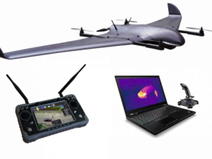
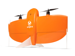
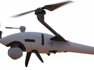
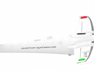
The long-range Sentera PHX fixed-wing platform is hot-swappable and accepts several different sensor types for capturing more data and gaining deeper agronomic insights.
Sentera PHX Fixed-Wing Drone
Get It Now, Pay Later
Free Delivery Nationwide On Orders Over R1999
Collect Safely Instore
Add ADK Repair & Maintenance Plan
Take every flight with confidence knowing your drone has crash protection and is kept in optimum flying condition
Get Your Drone Flying License
Wheather you are flying as a hobbyist or commercially, let our experienced drone flying instructors help you take your drone to the sky’s with ease.
Product Description
Sentera’s PHX™ is a highly-reliable, easy-to-use, hand-launchable fixed-wing drone that gives you the ability to view live HD video and capture a wide array of analytic data, including stand counts, weed locations, and plant health using the newest variants of the Sentera Double 4K sensor payload.
Leveraging a new long-range omnidirectional communication link, the PHX has a reach of 2+ miles, quickly scouting large fields with precision and is ideal for experienced pilots. The PHX is the best-performing and best-valued professional fixed-wing drone available today.
The PHX is hot-swappable, accepting several different sensor types – including ultra-precise RTK GPS Double 4K sensor payloads.
Industry-leading Outcomes:
- Deep Analytics: Purpose-build payload options allow you to perform stand count, weed detection, and plant health analytics. PHX is the only fixed-wing drone that maps stand counts and weed locations early in the growing season when action matters. Sentera’s FieldAgent™ data analytics software allows PHX users to create accurate maps and make decisions at the field edge without an internet connection.
- Long-range: By using an omnidirectional, industrial-grade communications link, the PHX is designed to fly up to two miles away or more. This is helpful for users with BVLOS permissions, and ideal for the average user who stays within the typical one-mile VLOS range.
- Fast Setup: A small, lightweight, plug-and-play communication box and streamlined pre-flight checklist enable you to easily go from setup to launch quickly and easily.
- Multiple Payload Options: The 2019 PHX accepts the newest versions of Sentera Double 4K sensors, allowing you to capture more crop health data and gain deeper insights. Ultra-precise RTK GPS is an available option for all PHX Double 4K sensor payloads.
With a cruise speed of 35mph and up to a 59-minute endurance, the PHX is capable of covering broad areas that other drones of the same size cannot. In a single flight, the PHX can collect data from 700 acres.
FEATURES
- Two or more mile range
- Accurately helps users address fertilizer, pesticide, and herbicide needs based on real-time data
- Increased operational efficiencies by permitting operators to capture RGB, NIR, NDVI, and NDRE imagery in a single flight (depending on payload variant ordered)
- Integrates seamlessly with Sentera FieldAgent web, mobile, and desktop software to further augment efficiencies
Industry Agnostic
The small, light drone is the next generation of the proven Sentera PHX fixed-wing platform. To optimize industry solutions, Sentera developed three distinct PHX variants that include the PHX drone, precision sensor, and all ground control software needed to get up and running.
Easy-to-use Flight Software
The intuitive flight software is compatible with Windows, iOS, Android, and Mac operating systems. Flexibility and easy comprehension of the ground control software ensure that the PHX solution will integrate into your operation.
Sensors
Sentera’s suite of precision payloads couple perfectly with the PHX UAV and support a multitude of applications. From search and rescue operations to infrastructure inspections to crop health surveys, the PHX seamlessly integrates Sentera’s industry-leading sensors and capture critical data that helps operations run more efficiently.
Imagery
The precision with which the PHX flies and the accuracy of Sentera’s sensors are changing the way industries approach remote sensing technology. Effortlessly capture high-precision, high-resolution color, NIR, and NDVI data. Captured data may be used to create detailed 3D maps, assisting geospatial analysts, engineers, inspectors, and first responders with measuring geographical volumes, analyzing surface data, and planning for contingencies.
Leverage Data
Every image you ever collect with the PHX drone is easily managed, stored, shared, and can be effortlessly leveraged using Sentera’s FieldAgent Mobile, Web, and Desktop platform.
Register to receive an email when stock arrives.
Sentera PHX Fixed-Wing Drone Product Inquiry
Drone Licencing Training Inquiry
Repair/Maintenance Care Plan
Same Day Delivery
Order before 9:00am and receive your parcel before 17:00 (JHB & PTA)
*If you order on Friday after 09:00am your parcel will be collected and delivered on Monday
Local Overnight (JHB & PTA)
Order before 13:00 and receive your parcel the next day
*If you order on Friday your parcel will be collected on Monday and delivered on Tuesday.
Nationwide Deliveries
Order before 13:00. Turnaround delivery time 1-3 days
*No delivery services available on weekends. Parcels are collected on Mondays.
Collect Safely Instore
Pre order and collect safely from our store, and get to meet our aweseome drone team
Important
Remotely operated hobby or toy aircraft and drone flying rules:
- • Do not, through act or omission, endanger the safety of any aircraft or person therein or any person or property through the negligent operation of any drone or remotely piloted aircraft, or model aircraft.
- • Fly or operate a drone or remotely piloted aircraft, toy or model aircraft 50 m or closer to:
- • any person or group of persons, on sports fields, road races, at schools or any social events.
- • any property without permission from the property owner.
Unless approved by the SACAA, do not fly or operate a drone, remotely piloted aircraft, toy or model aircraft:
- • near manned aircraft.
- • 10km or closer to an aerodrome which includes an airport, helipad or airfield.
- • a drone that weighs more than 7 kilograms (15.4 pounds), for which you don’t have a license.
- • in controlled airspace.
- • in restricted airspace.
- • in prohibited airspace.
Do not fly or operate a drone or remotely piloted aircraft, toy or model aircraft higher than (120m) 400 ft from the ground, unless approved by the Director of Civil Aviation of the SACAA.
General Basic Drone Flying Rules to which you must adhere:
- • You may not fly a drone within 10km of an airport.
- • You may not fly nearer than 50 metres from people, buildings or roads.
- • You may not fly a drone higher than 120m (400 feet).
- • ‘Hobby’ drones must be flown in within the line of sight.
- • Drones may not be flown at night.
Always fly your drone within your line of sight and below the highest obstacle in your vicinity.
For more information please see:
https://drone-laws.com/drone-laws-in-south-africa/
